|
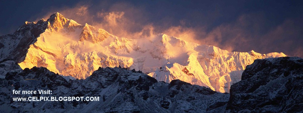
| Everest |
The Gokyo lake system of 19 lakes is spread over an area of 196.2 ha (485 acres) lying between 4,600 and 5,100 m (15,100 and 16,700 ft). The wetland lies on the head of the Dudh Kosi, which descends from Cho Oyo.
 |
| Gokyo Route-map |
 |
| everest_base_camp_trek |
 |
| Everest_in_back_on_left |
Gokyo Ri, aka Gokyo Peak (5357 m, 17 575 ft above sea level) is a peak in the Khumbu region of the Nepal Himalayas. It is located on the west side of the Ngozumpa Glacier, which is the largest glacier in Nepal, and reputed to be the largest in the whole Himalayas. Gokyo (4750 m, 15 583 ft above sea level), at the base of Gokyo Ri, is a small hamlet of a few stone houses. From Gokyo Ri it is possible to see five 8,000 metre peaks - Mount Everest, Lhotse, Makalu, Kangchenjunga, and Cho Oyu.
The Gokyo trek is a fairly popular trekking route. The route itself ends at Gokyo Ri, and trekkers typically turn around at this point and retrace their steps back to the trailhead. There is an alternative mountaineering route that begins near the southern tip of Ngozumpa Glacier and just south of Taujun Lake. This alternative route leads east over the Cho La, a pass at 5420 m (17 782 ft), where it meets with the main Everest Base Camp trek.
There is another higher summit just north of where the main Gokyo trek route ends. It stands at an altitude of 5483 m (17 988 ft) above sea level.
 |
| everest-gokyo-lake-view |
 |
| everest-base-camp-gokyo-lake |
Mt. Everest Gokyo Lake Trekking - 12-14 days
This trek begins at the mountain airstrip at Lukla a one hour flight from Kathmandu. The trek is an alternative for those who aspire to trek in Khumbu but want to avoid crowd and savour the tranquil nature in the high Himalayas with spectacular panoramic view of Himalayas. We follow the main trail of Everest base camp passing picturesque Sherpa villages and enjoying Sherpa hospitality up to Namche and take a different route ascending along the Dudh Koshi river through rhododendron and conifer forest to the yak herders' settlement of Gokyo valley. Serene beauty of Gokyo lakes in the shadow of snowcapped mountains and the spectacular view of high Himalayas including four of the world's highest 8000 meters peaks (Lhotse, Makalu, Cho Oyu and Mt. Everest. ) from Gokyo Ri enhance the trek. A traverse to Renjo La take us to tranquil Bhotekoshi valley following the historical trade route between Nepal and Tibet. Renjo La pass offers the unparallel panoramic views of snow capped mountains including Everest. We return to Lukla passing through Thame, a vantage point for the dramatic views of snow capped mountains not seen from anywhere in Khumbu.Itinerary
Day 01: Khamandu - Lukla by flight. Trek to Phakding.
Day 02: Trek to Namche Bazaar.
Day 03: Rest at Namche Bazar for acclimatization.(you may stay here one more day)
Day 04: Trek to Phortsethanga.
Day 05: Trek to Dole
Day 06: Trek to Machhermo
Day 07: Trek to Gokyo.
Day 08: Climb to Gokyo Ri.
Day 09: Trek to Renjo Pass - Lungden
Day 10: Trek to Thame
Day 11: Trek to Namche Bazar.
Day 12: Trek to Lukla.
Day 13: Lukla - Kathamandu by flight.
 |
| Gokyo lake nepal |
Trekking Equipments
The following equipment lists are suggested and essential for both camping & teahouse trekking in all trekking routes of NEpal. Make use of this list as a guideline proposal. Some of the Trekking equipments can be hired or bought in the many shops in Katmandu.
Equipments check lists
- Fleece jacket or pullover
- Warm cotton trousers
- Shirts and T-shirts
- Large plastic bag to put inside the bag
- Thermal underwear
- Lightweight cotton long pants
- Long under wear
- Short under wear
- Trekking boot
- Wollen socks
- Light socks
- Camp shoes /Sandals
- Sun hat or scarf
- Lightweight gloves
- Rain Proof coat
- Heavyweight gloves or mittens with a waterproof
- Sleeping bag
- Thermarest:
- Down jacket
- Daypack
- Water bottle
- Sun cream
- Sunglasses with UV protection
- Touch/headlamp with spare bulbs and batteries
- Lip care
 |
| Gokyo Cho Oyu Ridge To Gyachung Kang From Fourth Lake |
High altitude or mountain sickness is defined when someone feels sick at high altitudes, such as in the mountains or any other altitude-related sicknesses. It is hard to determine who will be affected by altitude-sickness as there are no specific factors that compare with this susceptibility to altitude sickness. However, most people can climb up to 2500 meters (8000 feet) normally.
Generally, different people have different susceptibilities to altitude sickness. For some otherwise healthy people, Acute Mountain Sickness (AMS) can begin to appear at around 2000 meters (6,500 feet) above sea level, such as at many mountain ski resorts, equivalent to a pressure of 80 kPa. AMS is the most frequent type of altitude sickness encountered. Symptoms often manifest themselves 6-10 hours after ascent and generally subside in 1 to 2 days, but they occasionally develop into the more serious conditions. Symptoms include headache, fatigue, stomach illness, dizziness, and sleep disturbance.
If you have altitude sickness, you must stay at least two nights at the same altitude until the symptoms have not gone away. If the symptoms of altitude are, worsen descends immediately.
Symptoms of acute mountains sickness (AMS)
1. Nausea
2. loss of appetite
3. Mild shortness of breath with exertion
4. sleep disturbance
5. Breathing irregularity, usually during sleep
6. Dizziness or light headaches
7. Mild weakness
8. Slight swelling of hand and face
Prevention of altitude sickness:What do we do in case of high altitude sickness emergency?
1. Drink at least three litters of water
2. escape from cold
3. ascent slowly
4. Never ascend with obvious symptoms
5. stay one or two more nights at the same altitude
6. avoid alcohol
7. avoid taking narcotic pain medications in more than modest doses
8. descends immediately if symptoms worsen
In the cases of mild symptoms, we suggest you to spend one or two night at the same altitude until the symptoms are not improved. In the case of emergency, you must visit to the nearest health post.
In case of emergency helicopter rescue service is available, required a guarantee for payment before the helicopter actually takes off.
Trekking Season
Trekking in Nepal is possible at any time of the year depending on where you are going. The most popular seasons are Autumn and Spring.
Autumn: Sep-Nov October and November are really Nepal's highest months - offering excellent weather and tantalizing mountain views.
Winter: Dec-Feb This season is noted for occasional snowfall only at higher elevations. Mountain passes may be snowbound, hence it is ideal for trekking at lower elevations, generally below 3000 meters.
Spring: Mar-May Different varieties of wild flowers, specially the rhododendrons, make the hillside above 5000 meters a haunting paradise during this season. It is mildly warm at lower elevations and at higher elevation over 4000 meters the mountain views are excellent and temperature is quite moderate.
Summer: Jun-Aug Summer months really continue up to mid-September making travel wet and warm. These times are blessed for the keen botanist as the higher valleys and meadows blossom with flowers and lush vegetation. Insect repellent is a nice addition to your What to Bring list. During this season, you can trek in the rain-shadow (places are out of reach of the rain clouds because of the high mountains) areas north of the Himalaya like Mustang and Dolpo.


Related Story : Mt. Lohtse
 |
| Gokyo Fifth Lake |
Trekking in Nepal is possible at any time of the year depending on where you are going. The most popular seasons are Autumn and Spring.
Autumn: Sep-Nov October and November are really Nepal's highest months - offering excellent weather and tantalizing mountain views.
Winter: Dec-Feb This season is noted for occasional snowfall only at higher elevations. Mountain passes may be snowbound, hence it is ideal for trekking at lower elevations, generally below 3000 meters.
Spring: Mar-May Different varieties of wild flowers, specially the rhododendrons, make the hillside above 5000 meters a haunting paradise during this season. It is mildly warm at lower elevations and at higher elevation over 4000 meters the mountain views are excellent and temperature is quite moderate.
Summer: Jun-Aug Summer months really continue up to mid-September making travel wet and warm. These times are blessed for the keen botanist as the higher valleys and meadows blossom with flowers and lush vegetation. Insect repellent is a nice addition to your What to Bring list. During this season, you can trek in the rain-shadow (places are out of reach of the rain clouds because of the high mountains) areas north of the Himalaya like Mustang and Dolpo.
 |
| gokyo lake |
 |
| gokyo lake |
 |
| gokyo lake |
 |
| gokyo lake |
 |
| gokyo lake |
 |
| Gokyo Valley Trek, Everest Gokyo Trek, Gokyo Ri, Gokyo Lake Trekking Nepal |


 |
| Lungsampa_Glacier |
 |
| map-everest-gokyo |
 |
| Rock_by_Gokyo_Lakes |
 |
| Sherpa_Memorial |
 |
| Sherpa_Memorial_Scott_Fisher |
 |
| Tabuche |
 |
| Tabuche_and_Cholatse |
 |
| To Gokyo 3-5 First Gokyo Lake Longpanga And Cho Oyu |
 |
| Yak_Train |
 |
| Yaks_in_Bhoti_Kosi_Valley |