|
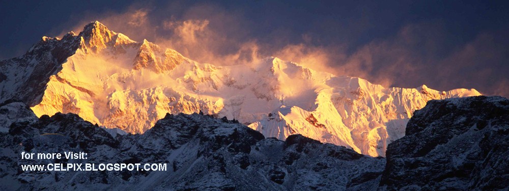
| Cho Oyu , Everest and Makalu |
Makalu has two notable subsidiary peaks. Kangchungtse, or Makalu II (7,678 m) lies about 3 km (2 mi) north-northwest of the main summit. Rising about 5 km (3.1 mi) north-northeast of the main summit across a broad plateau, and connected to Kangchungtse by a narrow, 7,200 m saddle, is Chomo Lonzo (7,804 m).
 |
| Chomo-Lonzo |
 |
| Makalu Trek From Mumbuk To Makalu Base Camp South, Makalu Sandy Camp, East Col, and West Col |

Makalu-Barun Valley is a himalayan glacier valley situated at the base of Mt. Makalu in the Sankhuwasabha district Nepal. This valley lies entirely inside the Makalu Barun National Park.
Barun Valley provides stunning contrasts, where high waterfalls cascade into deep gorges, craggy rocks rise from lush green forests, and colorful flowers bloom beneath white snow peaks. This unique landscape shelters some of the last pristine mountain ecosystems on earth. Rare species of animals and plants flourish in diverse climates and habitats, relatively undisturbed by human kind.
The first attempt of the Ski in the Himalayas expedition traveled along this valley to reach to the Makalu Base Camp.
 |
| Nord du Makalu 2 |

Makalu Trekking Route - Nepal
The trek to Makalu Base Camp in Nepal starts with a flight from Kathmandu to Tumlingtar (355m) and then driving or trekking to Mane Bhanjyang (1100m) and up to Chichilla (1830m) and down to Num (1500m).The trail then descends 870m to cross the Arun River (630m), ascends 830m to Sedua (1460m), and turns west to Tashigaon (2160m), the last settlement in the valley.
From Tashigaon, you climb in a lush cloud forest to the gateway into the Makalu-Barun National Park area at the top of the ridge (3190m), continue climbing to the few buildings and campsite of Kongma (3560m), the Kongma La (3850m) and three passes, including the Shipton La (4216m), before descending down to Mumbuk (3500m).
From Mumbuk the trail descends to the Barun Khola (3200m), and climbs up the Barun Valley to Yangle Kharka (3600m), Riphuk Kharka (3930m), and Jark Kharka (4210m), with mountains views ahead including Chamlang East (7235m) and Peak 6 / Mount Tutse (6758m). Beyond Langmale Kharka (4405m, also called Yak Kharka) the trail ascends alongside a moraine to Merek (4570m), and then turns west and then slightly north to Sherson (4660m) with the first views of Makalu. It takes just an hour to trek from Sherson to Makalu Base Camp South (4850m), with excellent views of the Makalu Southwest and South faces at sunset and sunrise.
The trail from Makalu Base Camp South (4850m) passes the Barun Pokhari before turning northwest and climbing an ablation valley on the west side of the Barun Glacier to Makalu Sandy Camp (5300m), with views of Nuptse, Lhotse, Lhotse Shar, Peak 38, Cho Polu, and Everest Kangshung East Face at the head of the valley, and once again sensational views of the Makalu West Face, West Pillar, and Southwest Face. The trail turns to the west from the Barun Valley and ascends steeply on enormous rocky boulders to a camp at around 5800m at the snout of the glacier leading to the East Col pass, once again with excellent views of the Makalu West Face, West Pillar, and Southwest Face.
The trail climbs up the glacier and then up the steep and rocky trail to the East Col (6135m) with views of Chamlang East, Hongu Chuli, P6770, and P6730 (Little Baruntse). We descended the other side of the East Col using a fixed rope and then trekked across the vast glacier to the West Col (6143m), with its views of Peak 41 / Kyashar, Hongu Peak, Malanphulan, Kangtega, Ombigaichen and Ama Dablam, Gauri Shankar, Menlungtse. and Taweche. After the 200m descent down the 50-55 degree snow and rock face from the West Col, it was all downhill, first on the glacier, then on muddy rocks towards Baruntse Base Camp (5450m) next to a lake, with views to Baruntse.
 |
| Kangchungtse, Cho Polu, Makalu La, Makalu, Island Peak |
This region is Due to its isolation and lack of tea houses this area still receives few trekkers. Sherpa, Rai and Limbus are main habitants in this area. Walking north up the Arun river to Sedua and Num, you get to the upper Barun Khola valley for a close look at Makalu (8,463m). You can put together even wilder trek by crossing Sherpani Col and west Col into the upper Hongu valley.
 |
| Langma La zum Makalu Chomolonzo |

Makalu Base Camp Trek - Itinerary
Day 01: Arrive Kathmandu .
Day 02: Sightseeing around of the Kathmandu valley.
Day 03: Flight: Kathmandu - Tumlingtar (860 m).
Trek to Khadbari (1,040m) (4 hrs). Camp
Day 04: Trek Khadbari to Chichila (1,830 m) (5/6 hrs). Camp
Day 05: Trek Chichila to Num (1,490 m) (5 hrs). Camp
Day 06: Trek Num to Sedua (1,460 m) (5/6 hrs). Camp
Day 07: Trek Sedua to Tashi Gaon (2,070 m) (5 hrs). Camp
Day 08: Trek Tashi Gaon to Kauma (3,470 m) (6 hrs). Camp
Day 09: Rest / Exploration day at Kauma. Camp
Day 10: Trek Kauma to Mumbuk (3,570 m) (5 hrs). Camp
Day 11: Trek Mumbuk to Nhe Kharka (3,000 m) (6 hrs). Camp
Day 12: Trek Nhe Kharka to Sherson (4,615 m) (7 hrs). Camp
Day 13: Trek Sherson to Makalu Base Camp (5,000 m) (4/5 hrs). Camp
Day 14: Explore Makalu Base Camp.
Day 15: Trek Makalu Base Camp to Nhe Kharka (3,000 m) (7 hrs). Camp
Day 16: Trek Nhe kharka to Mumbuk (3,570 m) (6 hrs). Camp
Day 17: Trek Mumbuk to Kauma (3,470m) (5 hrs). Camp
Day 18: Trek Kauma to Tashi Gaon (2,070 m) (5 hrs). Camp
Day 19: Trek Tashi Gaun to Pukuwa (1,520 m) (6 hrs). Camp
Day 20: Trek Pukuwa to Bumling (1,160 m) (5 hrs). Camp
Day 21: Trek Bumling to Tumlingtar (860 m) (4 hrs). Camp.
Day 22: Flight: Tumlingtar - Kathmandu.
Day 23: Free day to explore, and enjoy Kathmandu.
Day 24: Final Departure.
 |
| Makalu |
 |
| Makalu |
1. Makalu From Mountain Flight - perfect view of the west face and west pillar.
2. Makalu North Face - lurking above Chomlonzo is the final stretch of the normal route to the summit.
3. Chomolonzo North Face - the three peaks of Chomolonzo look striking from the north.
4. Makalu From Gokyo - Gokyo has probably the second best mountain panorama in the world, including Makalu.
5. Kangchentse West face - Kangshung Base Camp has probably the best mountain panorama in the world, including Kangchentse.
 |
| Makalu |
 |
| Makalu |
 |
| Makalu valley |
 |
| Makalu |
 |
| Makalu Climbing |
 |
| Makalu |
 |
| Makalu and river |
 |
| MAKALU LA ROUTE 1 |
 |
| MAKALU LA ROUTE 2 |
 |
| Makalu North Face From Shao La In Tibet |
 |
| Makalu West Face |
 |
| Makalu West Face, West Pillar, Southwest Face In Last Rays Of Sunset From East Col Camp |
 |
| Makalu_from_Island_Peak |
 |
| Makalu Summit Chomo Lonzo |
 |
| Makalu_und_Icecol |
 |
| Makalu-base-camp |
 |
| Makalu-high-camp |
 |
| Mount Makalu and Mount Chomolonzo, Tibet |
Want to add something? Find anything Missing? Please comment below.
Related post: Gokyo Ri and Gokyo Lake Trekking